
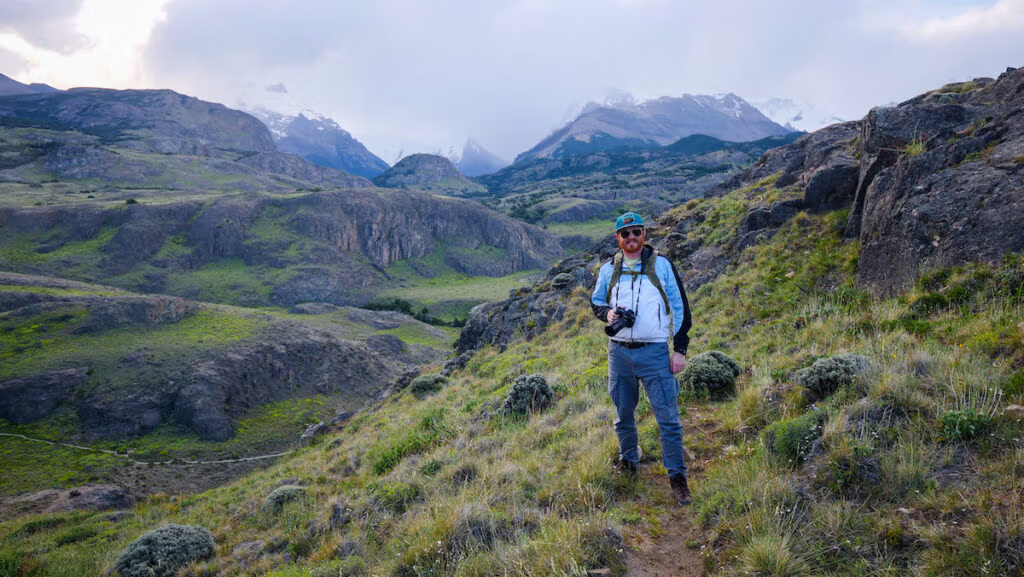
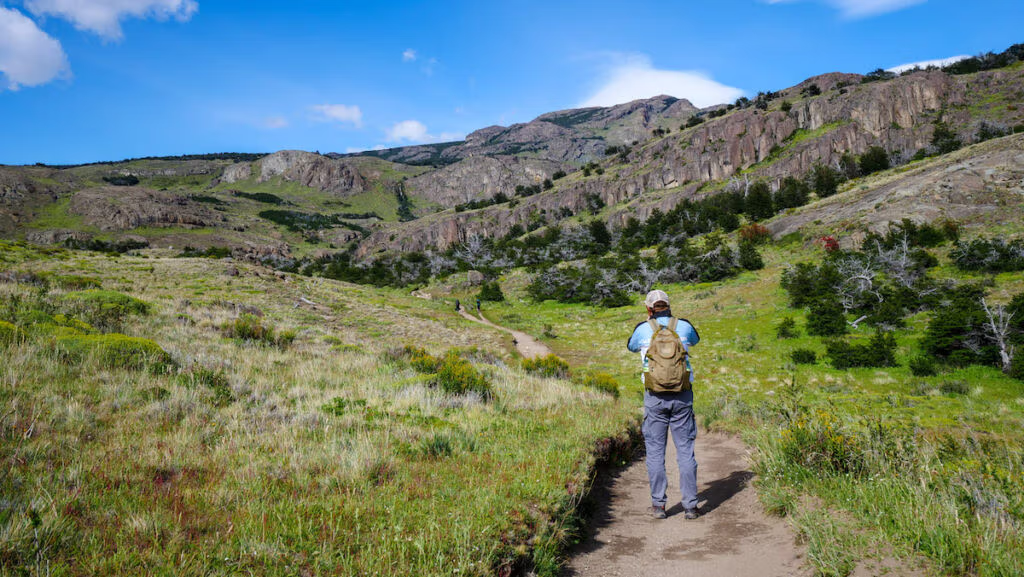
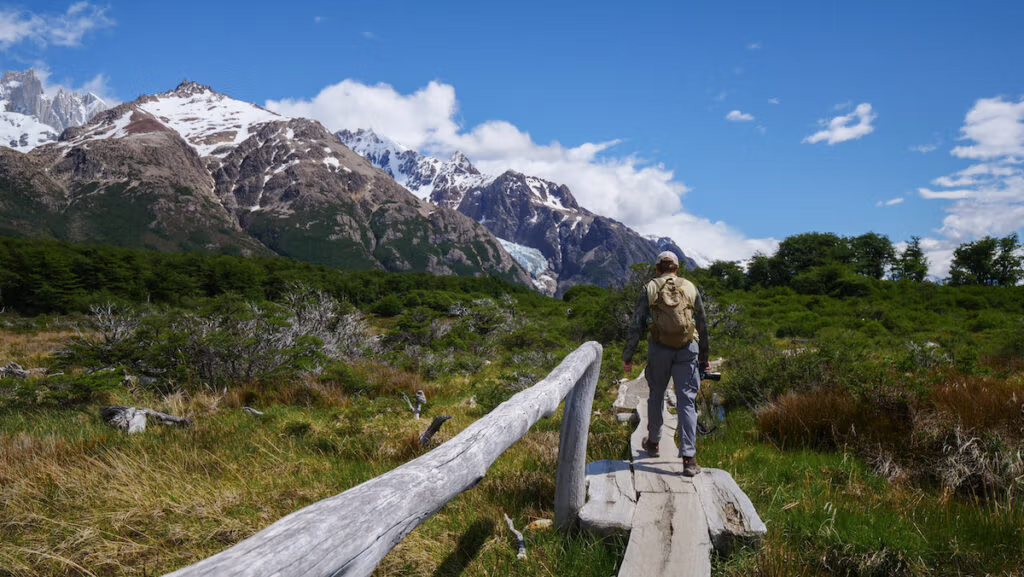
After spending a week hiking in El Chaltén, I can confidently say this is one of the most jaw-dropping destinations for trekking in all of South America!
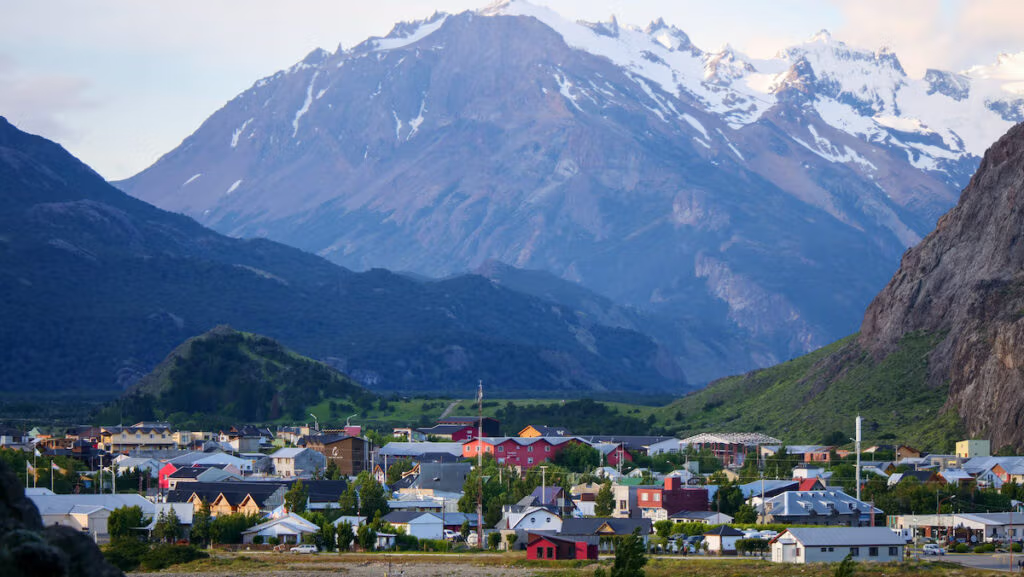
Often referred to as the trekking capital of Argentina, this small mountain town in Los Glaciares National Park offers an unparalleled mix of dramatic landscapes featuring glacier-fed lagoons and the towering granite peaks of Mount Fitz Roy and Cerro Torre.
Whether you’re tackling short scenic strolls or gruelling full-day mountain adventures, the diversity of hikes in El Chaltén is what makes it accessible to beginners and experienced trekkers alike.
I’m breaking down the 15 best El Chaltén hikes organized by difficulty (easy, moderate, and challenging!) with trail descriptions, distances, duration, and pro tips from our own time on the ground.
We’ve done the legwork (quite literally!) so you can skip the guesswork and focus on what matters: epic views, glacier-fed lakes, and the raw beauty of Patagonia.
So if you’re planning a hiking trip to Patagonia, lace up your hiking boots because this El Chalten hiking guide is for you!
Easy Hikes in El Chalten
These hikes are perfect for beginners, families, or travellers looking to warm up for bigger adventures. They offer excellent views with minimal elevation gain.
1. Mirador del Cóndor
- Distance: 2.6 km round-trip
- Elevation: 129 metres
- Time: 45 minutes to 1 hour
- Difficulty: Easy
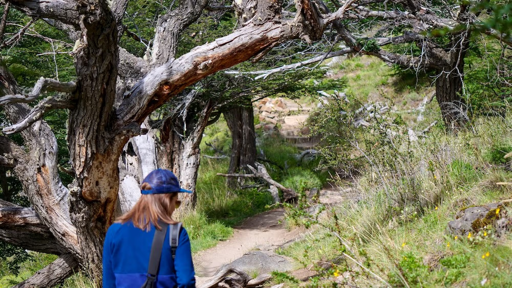
Mirador del Cóndor, also known as the Condor Lookout, is one of the most accessible short hikes in El Chaltén, offering a rewarding viewpoint with minimal time commitment. The trail begins behind the Centro de Visitantes (Park Ranger Station) and stretches just 2.6 kilometres round-trip, taking about 45 minutes to 1 hour to complete.
The path climbs gently through lenga shrubs and open terrain, making it easy for hikers of all levels. Yes, it’s a bit steep at times, but it’s a short distance. We saw families with young children tackling this hiking trail, so that gives you an idea of the level of difficulty.
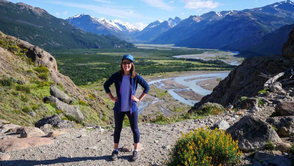
We chose to do this hike on the very first day we arrived in El Chalten from El Calafate to warm up for the bigger treks ahead. We went up in the late afternoon just in time to catch sunset, and we were not disappointed.
At the viewpoint, we were treated to views of the town of El Chaltén, the Río de las Vueltas Valley and Mount Fitz Roy dominating the horizon – the latter was a very cool and unexpected surprise!
If you’re lucky, you may even spot Andean condors soaring overhead, hence the name of the trail.
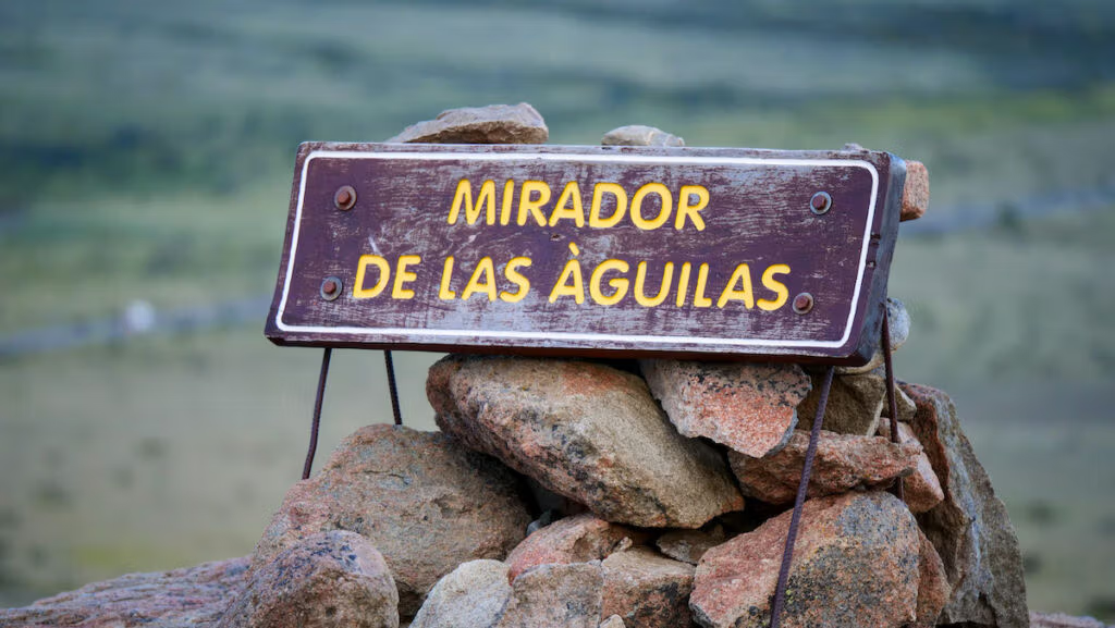
2. Mirador del Águila
- Distance: 7.2 kilometres loop trail
- Elevation: 213 metres
- Time: 2 hours
- Difficulty: Easy
Mirador del Águila is a 7.2-kilometre hike that can be done as an extension to the above-mentioned Mirador del Condor.
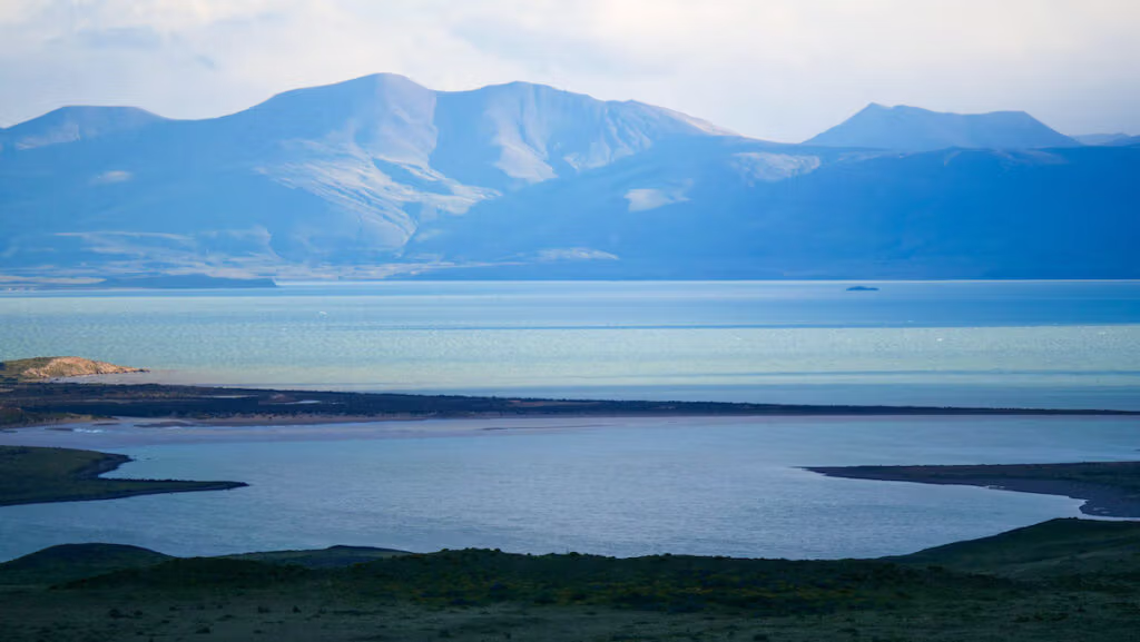
The start of the hike is the same, and once you reach the Condor Lookout, you continue on a loop that brings you to another lookout point with views of Lago Viedma.
Aside from the initial ascent, this is a relatively flat and gentle trail, making it ideal for a relaxing outing. If you’re looking for a sunrise hike, I would recommend this one.
There are fewer crowds and a greater chance of spotting native birds like the carancho or the black-chested buzzard-eagle. You can also expect to encounter some free-roaming cows along the way!
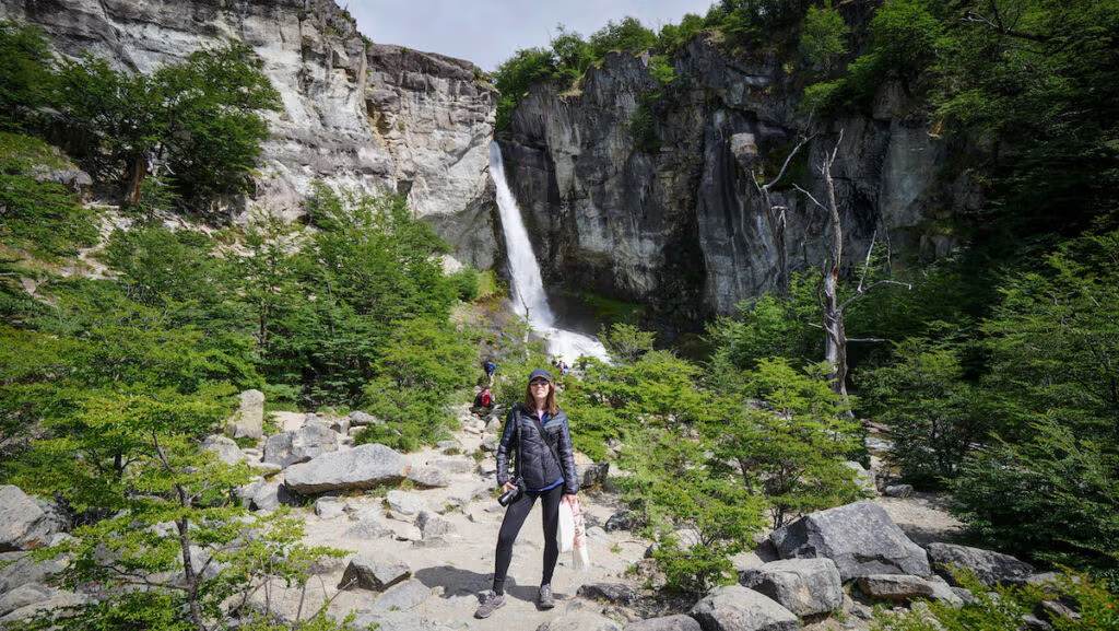
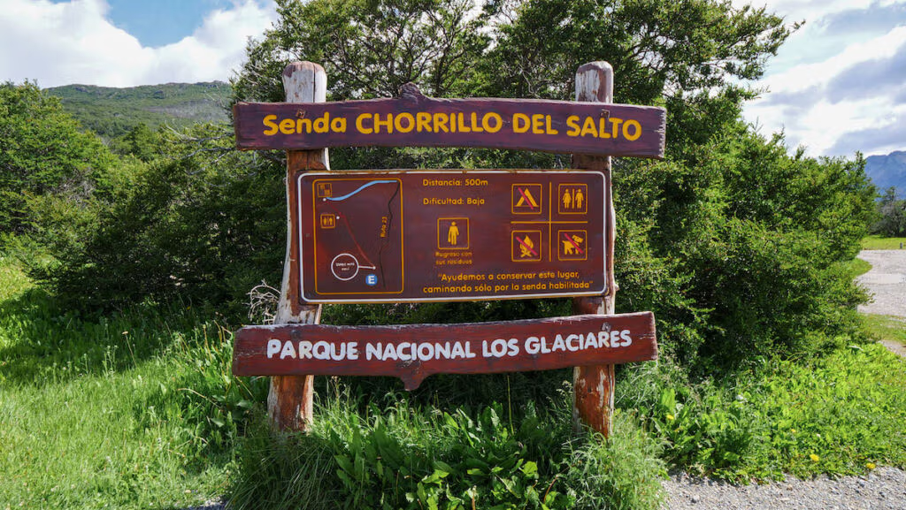
3. Chorrillo del Salto
- Difficulty: Easy
- Elevation: 139 metres
- Distance: 1 km (trail from parking lot) or 7 km if walking from town
- Time: 30–45 minutes
This short, flat trail in El Chaltén leads to a picturesque 20-meter waterfall tucked away in the lenga forest. It’s easily accessible by car (there’s a parking lot right by the falls) or bike (you can cycle from town) and is ideal for families or travellers who want a quick nature fix.
The downside of the Chorrillo del Salto hike is that most of the trail is along Provincial Route 23, a dirt road that gets some vehicle traffic, which left us walking in a cloud of dust.
We hiked all the way from town, so we found it lacked the charm of hiking in the middle of nature. That being said, the waterfall is nice, and it’s one of the easier and more accessible hikes in El Chalten.
4. Mirador Cascada Margarita
- Distance: 1.4 kilometres
- Elevation: 80 metres
- Time: Under 1 hour
- Difficulty: Easy
Another easy hike in El Chalten is Mirador Cascada Margarita. This is a short hike that leads to a viewpoint where you can see Margarita Waterfall across the canyon.
To do this hike, you take the Laguna Torre trailhead and do the first segment of the trail until you reach the 0.7-kilometre mark. This lookout point is the first stop of the much longer Laguna Torre trek, plus you also get your first glimpse of Cerro Torre.
We completed this hike on our way to Laguna Torre, however, you can do it as a quick standalone hike.
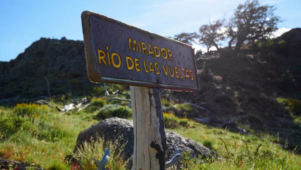
5. Sendero Río de las Vueltas
- Distance: 3 km round-trip
- Elevation: 106 metres
- Time: 1 hour
- Difficulty: Easy
Sendero Río de las Vueltas is another easy hike in El Chalten. It’s on the way to Laguna Capri and Laguna de los Tres, so you’ll cover it if you’re doing either of those hikes.
The downside of Sendero Río de las Vueltas is that it can be quite busy in the morning when hikers set out to complete some of the longer hikes. You may find yourself hiking in single file, but the crowds eventually disperse. We stopped to rest on the log benches at this lookout point.
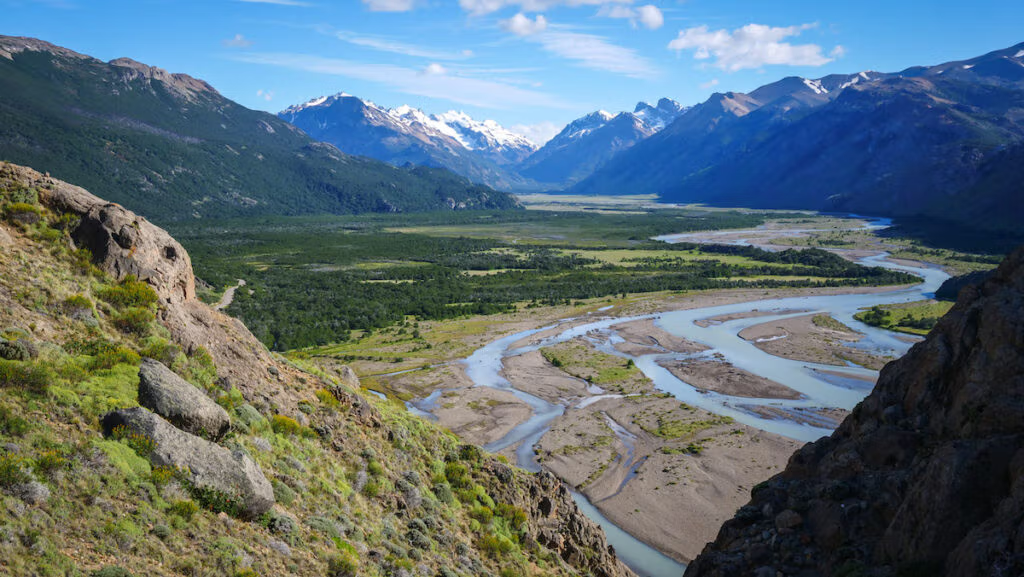
This hike offers beautiful panoramic views of Río de las Vueltas, literally the River of Turns, which is quite aptly named, as you can see in the photo! You also get views of the valley below and the mountain chain.
There are 106 metres of elevation gain on this trail, which at times feels a bit steep, but it’s a short hike.
6. Laguna Capri
- Distance: Approximately 8 km round trip
- Elevation: 424 metres
- Duration: 2–3 hours
- Difficulty: Easy to moderate
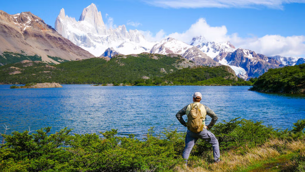
If you want epic views for relatively low effort, I would suggest the Laguna Capri hike. It leads you to a gorgeous azure lake with Mount Fitz Roy standing proud in the background. It’s something straight out of a postcard. I remember feeling it should require more effort to earn such epic views!
This is a very doable hike for those with limited time or seeking a less strenuous option. The trail is around 8 kilometres round-trip and takes 2 to 3 hours to complete.
The Laguna Capri trail shares its initial stretch with the Laguna de los Tres hike. In fact, the day we hiked to Laguna de los Tres, we had only planned to go as far as Laguna Capri! However, we arrived relatively early and were feeling strong, so we decided to continue on. But had we not, the plan was to spend the day lakeside and soak in the views.
This is also a great picnic spot; we had already eaten most of our lunch by the time we got here, but it’s a great place to linger.
I would say this is an excellent hike for families, beginner hikers, or even those acclimatizing for longer treks.
7. Glaciar Huemul
- Distance: Approximately 3 km round trip
- Elevation: 211 metres
- Duration: 1.5–2 hours
- Difficulty: Easy
Hiking to Glaciar Huemul requires renting a car or arranging some form of transportation since this trail is an hour’s drive north of El Chaltén. The trailhead is near the Lago del Desierto Campground on the south shore of the lake.
The hike to Glaciar Huemul is a short 3 kilometres round-trip that takes just 1.5 to 2 hours. The trail offers views of Lago del Desierto, Cordón del Bosque, the north face of Cerro Chaltén, and the Río de las Vueltas Valley.
The trail winds uphill through a private reserve and features mossy forest, wooden bridges, and crystal-clear streams. Though it’s a short hike, the ascent is steady and can be slippery after rain.
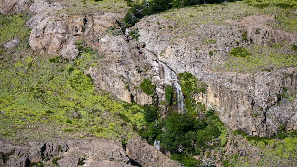
At the top, hikers are rewarded with a spectacular view of the hanging Huemul Glacier spilling down a cliff face into a turquoise lagoon below.
This is a great half-day adventure if you’re after glacier views without the effort of a full-day trek.
8. Laguna Azul
- Distance: 5 km round trip
- Elevation gain: 80-100 m
- Duration: 2 hours
- Difficulty: Easy
Laguna Azul translates to ‘Blue Lagoon’ and it’s an easy trek that starts 17 kilometres north of El Chalten.
Tucked within the private reserve of Estancia Los Huemules, the trail to Laguna Azul offers a peaceful contrast to the busier routes inside Los Glaciares National Park.
The hike starts from the reserve’s visitor center and winds through lenga forest, crossing a footbridge over the Río Diablo before gaining some gentle elevation.
Near the end, the path skirts a small waterfall and includes a final creek crossing before arriving at a crystal-clear lagoon framed by forest and rugged hills.
If you wish to press on, a short ridge walk beyond Laguna Azul leads to Laguna Verde, offering views of Fitz Roy’s north face peeking behind Cerro Eléctrico.
Because Laguna Azul sits in a private reserve, the hike requires an entrance fee. Last season, the price was 28,000 ARS ($20 USD) per person, but you can check their current rates on their website. On the bright side, you can tackle 5 different hikes within the nature reserve.
Moderate Hikes in El Chaltén
These intermediate trails are longer and involve more elevation gain, but remain accessible to most fit hikers. They can be done as half-day or full-day trips. You can easily squeeze a couple of these into your itinerary, even if you only have 3 days in El Chalten.
9. El Paredón
- Distance: 3.7 kilometres
- Elevation: 299 metres
- Duration: 1.5 hours
- Difficulty: Moderate
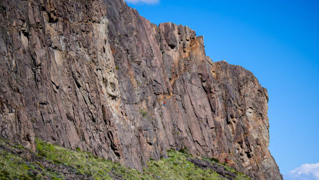
If you want to enjoy views of El Chalten without the crowds, I think the trek to El Paredón is a wonderful alternative. The name El Paredón literally translates to ‘the wall’, referring to the massive rock wall that overlooks the Las Vueltas River.
In fact, during our first day in El Chaltén, my husband and I noticed that there were loads of rock climbers going up the paredón. We did the Costanera walk along the riverside just so that we could watch them in action! However, it’s also possible to go up.
The trail starts on the east end of town as soon as you cross the bridge over the Las Vueltas River. The trail then immediately heads south along the river’s edge and slowly winds north again as you begin the ascent to the top of the rock wall.
While this is considered a moderate hike in terms of difficulty, it does get steeper the further you go, with the final ascent being the steepest. It’s a mostly dirt trail and is slippery in some sections, so expect a bit of scrambling.
The reward is the view of the town below, the Las Vueltas River, and the peaks of Fitz Roy off in the horizon. The El Paredón hike is a nice option to catch sunrise or sunset. Just be prepared for it to be windy up there!
Consider this a warm-up hike for some of the bigger treks in El Chalten.

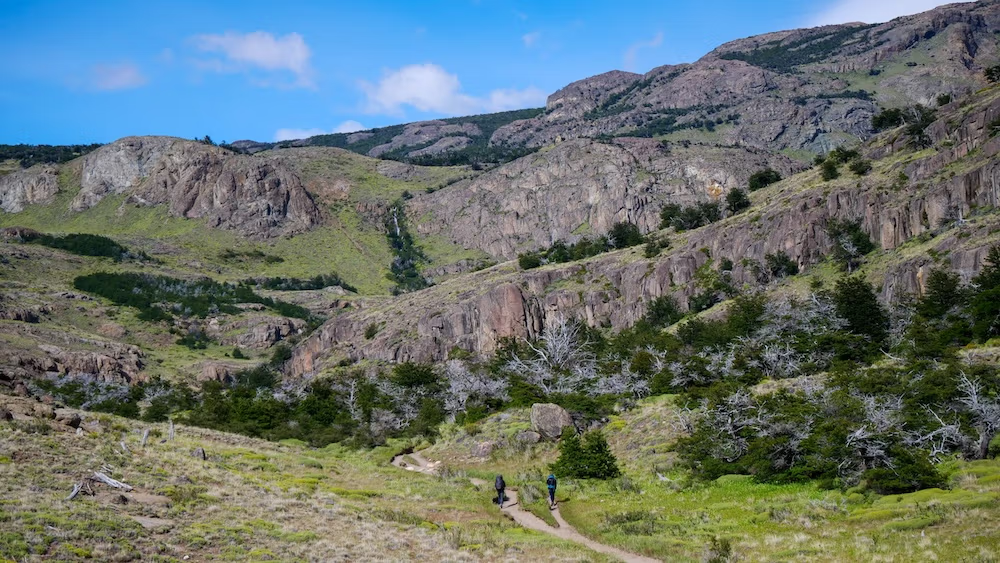
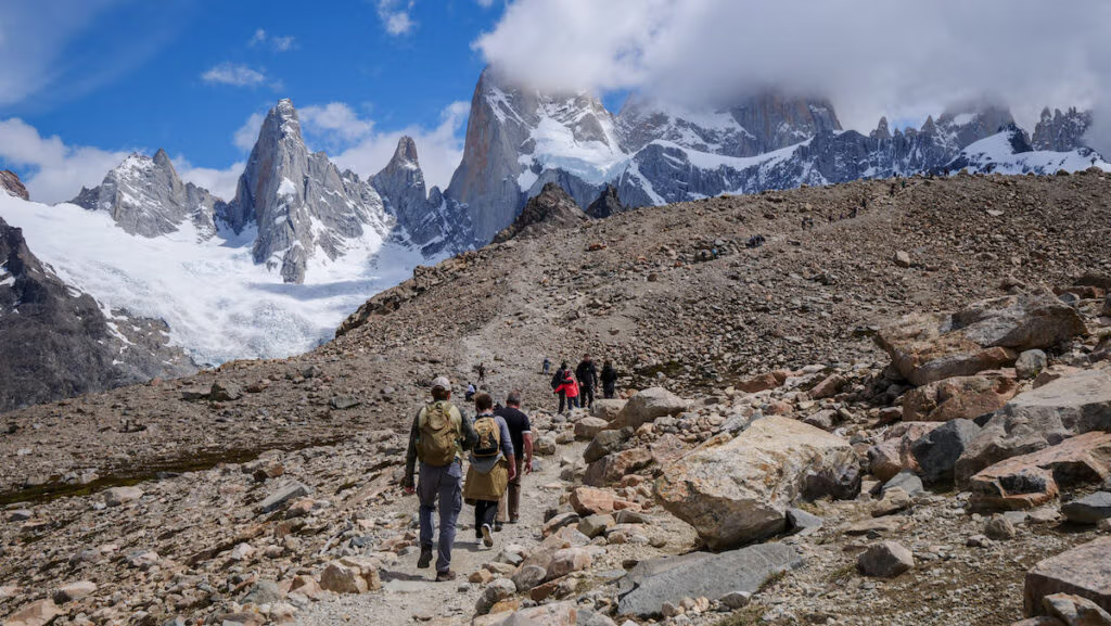
10. Cerro Torre
- Distance: 17.5 km round trip
- Elevation: 571 metres
- Duration: 6–8 hours
- Difficulty: Moderate
The hike to Cerro Torre is one of those classic treks in El Chaltén that you can’t skip. It’s also known as the Laguna Torre hike since it brings you to the lagoon at the base of the mountain.
Cerro Torre is actually the tallest in a chain of four that also includes Torre Egger, Punta Herron, and Cerro Standhardt. Pretty epic lineup, right?
The full hike is about 17.5 kilometres round trip. Most people take around 6 to 7 hours to do it, but of course, it depends on how fast you walk and what the trail is like that day (parts can get pretty muddy). Difficulty-wise, it’s considered moderately challenging.
The trail kicks off through a gorgeous valley, and along the way, you’ll spot some waterfalls. The steepest part of the climb happens right at the start, but once you get to around kilometre 3.5, things flatten out, which makes it easier to find a rhythm and cover more ground at a steady pace.
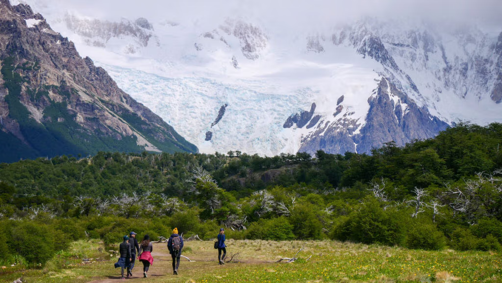
One of the things that kept us going on this trail was the fact that we could see Torre Glacier in the distance – it felt like the glacier was cheering us on. Plus, the route kept things interesting: we wandered through forests, along a river, and the scenery was always changing.
The big reward came at the end when we reached the viewpoint over Laguna Torre, a glacial lake sitting right at the base of Cerro Torre. Sometimes there are little icebergs floating around, and with that mountain backdrop, it’s a dream spot for photos.
The only bummer for us was that by the time we got there, clouds had rolled in and covered Cerro Torre, so we missed that postcard-perfect view.
If you’ve still got some energy once you hit Laguna Torre, you can keep going a bit further to Mirador Maestri. From there, you get even better views of the Torre Glacier.
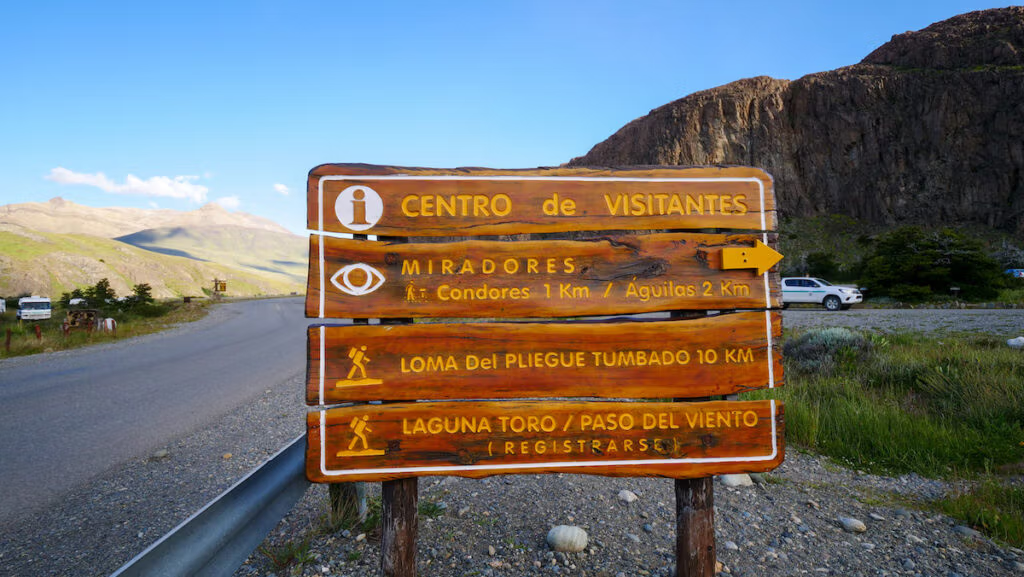
11. Loma del Pliegue Tumbado
- Distance: Approximately 20 km round trip
- Elevation: 1132 metres
- Duration: 7–9 hours
- Difficulty: Moderate to challenging
If you’re looking for a hike in El Chaltén that’s a bit less crowded than the super popular ones like Laguna de los Tres or Laguna Torre, then Loma del Pliegue Tumbado is a solid choice.
The trail starts right at the Visitor Center (same spot as Mirador de Los Cóndores and Mirador de Las Águilas), but instead of going left, you’ll see a marker pointing you to the right.
The path takes you through patches of forest, and then you come out onto this wide-open flat area called Pampa de las Carretas. From there, the climb continues, and you eventually hike past the timberline.
The last stretch is definitely the toughest; it’s steep, you gain elevation fast, and there are switchbacks with loose rock that keep you on your toes. But honestly, the views at the top make all of it worth it.
At the summit, you get this jaw-dropping 360-degree panorama of the whole area: Mount Fitz Roy, Cerro Torre, Lake Viedma, Cerro Huemul, and even the Río Túnel Valley.
Of course, those views are earned via an elevation gain of nearly 1,000 meters. The big joke with this hike is that “The only time you don’t go up is when you go down!” You’ve been warned.
12. Piedra del Fraile
- Distance: 14 km round-trip
- Elevation: 262 metres
- Time: 4–5 hours
- Difficulty: Moderate
The hike to Piedra Frail is one of those that requires transportation. It starts 17 kilometres outside of El Chalten; the trailhead is at the Río Eléctrico bridge on Provincial Route 41. That means you’ll need to rent a car, arrange a taxi or join a guided hiking tour that provides transportation.
The hike gets its name from the piedra or boulder that was dumped in the valley by the glacier. The trail starts off in an open area, goes through shrubbery, and then enters the lenga forest, but it always stays close to the Electric River.
Piedra del Fraile has a small campsite and refuge that acts as the first overnight stop for hikers who are tackling bigger hikes to Pollone Lagoon, the Marconi Glacier or the Paso del Cuadrado. Keep in mind that these are more challenging hikes that require special equipment and more technical experience, so you’ll want to consult with the National Parks Administration before heading out.
13. Piedras Blancas
- Difficulty: Moderate
- Elevation gain: 230–300 metres
- Distance: 13.2 km (there are variants depending on route)
- Time: 3.5 to 4 hours round-trip
The Piedras Blancas trail, often called Mirador Piedras Blancas or Glaciar Piedras Blancas Viewpoint, is a quieter glacier-view alternative to the main Fitz Roy treks.
Starting from the bridge over the Río Blanco (near El Pilar / Route 41), the route first passes through forests and follows the river corridor before rising gently toward a viewpoint overlooking the Piedras Blancas Glacier.
Along the way, you pass through lenga woods, cross into Los Glaciares National Park, and enjoy views of Cerro Eléctrico and parts of the Fitz Roy massif.
Because this trail branches off and intersects with parts of the Laguna de los Tres route, many hikers integrate it as a side excursion rather than a standalone hike.
The glacier itself sits around 2,000 metres away from the viewpoint, and you may see icefalls and glacier ice movement on clear days.
Difficult Hikes in El Chaltén
These challenging hikes involve long distances, steep ascents, and more technical terrain. Perfect for seasoned trekkers seeking Patagonia’s most iconic vistas.
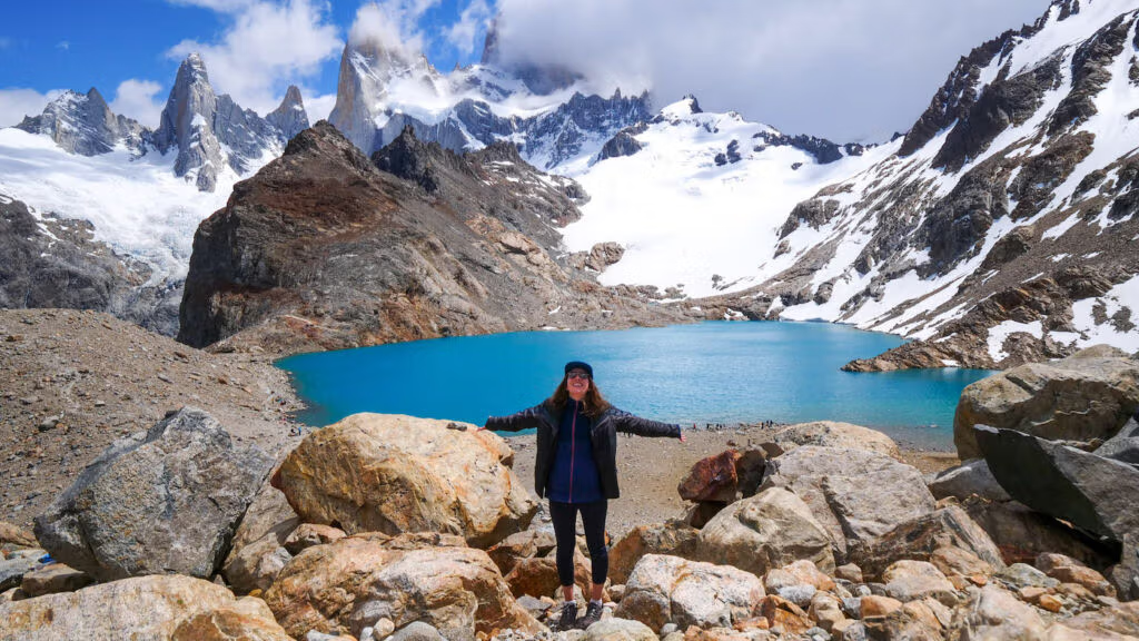
14. Laguna de los Tres
- Distance: Approximately 22 km round trip
- Elevation: 1053 metres
- Duration: 8–10 hours
- Difficulty: Challenging
The hike to Laguna de los Tres is hands down one of the most spectacular day treks in El Chaltén, and it honestly lives up to the hype. This was the first big hike that we tackled on our visit, and we started out with a bang!
The name actually means “Lagoon of the Three,” and it’s a nod to those three peaks: Fitz Roy (3,405 m), Poincenot (3,002 m), and Saint-Exupéry (2,558 m).
Now, just a heads up: this isn’t a casual stroll, so you’re looking at a full-on trekking day. Most people take 8 to 10 hours, depending on pace and fitness. It’s definitely a challenging one, not only because of the distance, but also because the final kilometres culminate in a steep and strenuous ascent that climbs 400 meters.
Trekking poles? Highly recommended.
I’ll be honest, during that final kilometre, I seriously considered turning around. I was so tired, and the climb ahead seemed unending. It was the encouragement from hikers coming down telling us, “Don’t give up, it’s so worth it!” that kept us going.
Once we finally made it over the ridge, I understood what they meant. You’re rewarded with this stunning glacial lagoon framed by a glacier and massive granite peaks. The lagoon was this perfect deep blue, the glacier snaked down the mountain, and clouds drifted dramatically over Mount Fitz Roy and the surrounding peaks. It was one of those jaw-dropping moments where all the pain of the trek just melted away.
Sam and I huddled behind a big boulder to escape the wind, pulled out what was left of our packed lunch, and just sat there soaking in the view until it was time to face the steep descent and long walk back to El Chaltén.
I’ll be honest, Laguna de los Tres isn’t for everyone; it’s demanding and long, but if you’re up for the challenge, the payoff is unforgettable. It’s one of the best Patagonia hikes for the views alone!
Multi-day Hikes in El Chalten
15. Huemul Circuit
- Distance: 65 km loop
- Elevation: 2,838 metres
- Time: 4 days
- Difficulty: Very Difficult
If you’re a hardcore hiker and you’re looking to challenge yourself in El Chalten with a multi-day trek, then consider the Huemul Circuit.
Let me be very clear, this trip is NOT for beginners! The route involves river crossings, unpredictably windy mountain passes, a scree field, an ever-changing glacier and even two Tyrolean traverses. Not only do you need adequate gear, but you also need the experience to navigate the demanding terrain.
The rewards are the views of the South Patagonian Ice Field, the world’s third-largest ice field (after those in Antarctica and Greenland) and aside from getting on a helicopter, this is the only way to see it!
The Huemules trek is typically completed in 4 days and 3 nights. However, it’s important to keep in mind that this is a weather-dependent trek that can and will get cancelled if the winds are deemed too strong – this is especially important on days 2 and 3.
I would recommend reading this detailed first-hand account of the trek so you know what to expect.
Updated: Hiking Fees in El Chaltén
NOTE: As of October 2024, Los Glaciares National Park, which encompasses most of the popular hiking trails out of El Chaltén, has introduced a mandatory entrance fee (view current rates here).
If you visited El Chaltén when hiking was free, like I did, you may be in for a bit of a surprise on your return visit. New fees have been introduced, and these are supposed to fund trail maintenance and conservation efforts, helping ensure the region stays pristine for future visitors. However, the prices are a bit steep!
Note that these are the rates for foreign visitors, which are listed as ‘general admission’. If you are a national visitor or a provincial resident of Santa Cruz, the fees are much lower.
- 1‑day pass – 45,000 ARS ($45 USD)
- 3‑day pass – 90,000 ARS ($90 USD)
- 7‑day pass – 157,500 ARS ($157 USD)
These passes can be purchased online in advance or at one of the entry gates near trailheads around El Chaltén.
Note that not all trails require fees. For instance, hikes outside the park remain free of charge. However, most people come to El Chaltén to tackle the famous trails!
Some travellers also report they can avoid paying by starting hikes before 7 a.m. or after 6 p.m., when control booths at the trailheads are unstaffed, though this shouldn’t be relied on as a strategy.
Final Tips for Hiking in El Chaltén
Hit the trails early.
Start early for the best light, fewer crowds, and increased wildlife sightings. Many of El Chaltén’s hikes are most beautiful at sunrise or early morning, when the peaks of Fitz Roy and Cerro Torre glow orange and pink. Starting early not only improves your chances of seeing wildlife like condors or foxes but also helps you avoid strong afternoon winds and trail congestion.
Most trails start in town.
All hikes start in or near town, so you can base yourself in one spot without needing transport. One of the great advantages of El Chaltén is its compact layout; once you get to town, nearly all major trailheads are accessible on foot. This means you can stay in a central hotel and still walk to every hike, no car or shuttle needed. That is, unless you’re tackling some hikes outside the park or in private nature reserves.
Check the weather before each hike.
The weather in Patagonia is famously unpredictable and can change quite rapidly. Clear skies in the morning can turn into rain, wind, or snow within hours. Always check the day’s forecast at your accommodation or the visitor center before setting out.
Use Windguru to see the wind forecast.
Strong winds are a defining feature of the region, especially in the afternoon. Local hikers and guides use Windguru to get detailed wind forecasts. It’s a great tool to know if your hike will be breezy or a battle. We also found this website super helpful when booking our day excursions in El Calafate, especially our glacier boat tour, because we wanted good weather that day!
Pack the essentials in your day pack.
Bring layers, sunscreen, snacks, and water for every hike – even the short ones. Weather conditions can change dramatically throughout the day, so dress in layers and pack essentials like a windbreaker, gloves, and sun protection. Even on short hikes, it’s best to be prepared.
Camping is allowed in designated sites.
If you’re planning to do multi-day hikes, there are designated backcountry campsites such as Campamento Poincenot and Campamento De Agostini. These sites have basic amenities and are first-come, first-served. Bring your own gear and follow Leave No Trace principles.
Rent gear in El Chaltén.
Don’t worry if you didn’t pack trekking poles or a tent. El Chaltén has several outdoor outfitters where you can rent everything from sleeping bags to camp stoves.
Build in recovery days.
If you’re building an itinerary, mix a few easy day hikes for recovery days with one or two major treks like Laguna de los Tres or Laguna Torre. We could not move after tackling our first 20+ kilometre hike; we needed a full day to sleep, stretch and hobble around! Other people like to treat themselves to a fancy dome stay as a reward for completing all their hikes. The choice is yours.
Don’t bypass El Calafate
Once you’re done trekking in El Chalten, be sure to spend a few days in El Calafate. This town sits on the south end of Los Glaciares National Park, and this section of the park has a series of trails and boardwalks where you can see glaciers and icebergs, the most famous of them all being the Perito Moreno Glacier. It’s a completely different experience! You can find my complete El Calafate travel guide to help you plan your visit.
GROUP TOURS – If you’d rather join a group tour to travel in Argentina, check out Gadventures.
CAR RENTAL – To explore Argentina beyond the cities, the best way to do so is by renting a car. Discover Cars offers rentals across the country.
BUS TICKETS – Bus travel is a great way to see Argentina. BusBud offers numerous routes.
TRAVEL INSURANCE – Don’t leave on your trip without booking travel insurance. You can get a quote on SafetyWing.
HOTELS – Booking.com offers accommodations to suit all budgets and travel styles.
TOURS – For a variety of tours and activities, have a look at Viator.